

Roineabhal [Roineval]
Good walks are even better shared.
Overview
Roineabhal [Roineval]
Roineabhal, standing at 799 meters, is a shining gem in the Scottish Highlands, classified as a Marilyn. Located near NB232212, this striking mountain features stunning geological formations of ancient Lewisian Gneiss, giving it a rugged yet beautiful appearance.
Routes
Northwest Ridge
This is the more popular route, commencing from the picturesque Loch Roag. The hike covers around 8 kilometres and typically takes about 3.5 hours. This moderate route leads stubbornly upwards but rewards climbers with stunning views.
Southern Approach
For those who enjoy a leisurely pace, the Southern Approach offers more scenic vistas and a total distance of about 10.5 kilometres, taking roughly 4 hours. This route is perfect for soaking in the surroundings as you make your ascent.
Summit Features
Reaching the summit, you'll find a robust cairn that marks the highest point. It's a perfect spot for a photograph or—if you’ve packed a sandwich—a snack while watching the clouds drift lazily by.
Terrain & Hazards
Expect a mix of rocky outcrops and grass, with some boggy patches that can be a bit trickier, especially after a good rain. Always keep an eye on the weather as it can change rapidly; highland weather is as reliable as a politician's promise!
Views
The summit offers spectacular panoramic views of the Isles of Lewis and Harris, especially mesmerizing during the late spring and summer months. Autumn, however, is a sight to behold with the vibrant foliage.
Access & Facilities
The nearest parking is a small area close to the Northwest Ridge path, with Tarbert being the closest town for amenities. Here, you can find lovely cafés to prepare you for the climb ahead, but do remember: no one wants a full stomach on a steep incline!
History
The name Roineabhal evokes images of marshy slopes, hinting at its geographical character. It's rich in historical significance, providing insight into the culture and persistent allure of the Scottish highlands.
Remember, whether you claim the summit for a scenic photograph or simply appreciate her beauty from afar, Roineabhal [Roineval] is a destination that embodies the spirit of Scotland's wilderness. Happy Hiking!
Explore routes near Roineabhal [Roineval]
Public walks starting within 80 km of this hill. Nearby does not mean a route reaches the summit; check its map and access before setting out.
Beautiful private beach walk Isle of Harris
View route
Berneray Community Hall to the beautiful beach
View route
Fairy Lochs Liberator Wreckage Circuit
View route
Route planning notes
These notes describe possible approaches, not verified navigable routes or permission to cross land. Check current paths, local access rules and conditions before setting out.
Northwest Ridge
A popular route starting from the nearby Loch Roag, providing a straightforward ascent to the summit with stunning views along the way.
Southern Approach
This route meanders through enchanting glens, gradually ascending to the summit. A perfect choice for those who prefer a less direct, more scenic hike.
Make a day of it, together
Find someone to share the walk with, or organise a day out along a route you like.
Photo Gallery
View all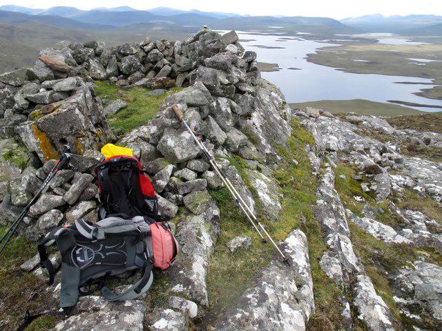 Photo could not load
NB2321 : Roineval [Ròineabhal]
Rude Health
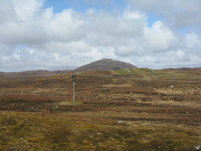 Photo could not load
NB2321 : Ròinebhal from the southeast
M J Richardson
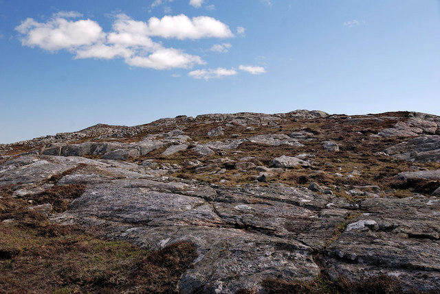 Photo could not load
NB2321 : Roineabhal
Stephen Branley
Hill facts and local notes
Classifications
Elevation
281m
922 ft
Prominence
203m
Coordinates
58.0933, -6.6973
NB232212
OS Map
13 14
Explorer: 457 458
At the Summit
The summit boasts a prominent cairn, which undoubtedly makes for a great photo-op. On a clear day, you might even find a friendly sheep lounging nearby.
Terrain & Geology
The mountain is primarily composed of Lewisian Gneiss, one of the oldest rock formations in the UK, offering a stark and ancient landscape. The rock is quite hard, which has contributed to the mountain's formidable profile.
Views & Scenery
From the summit, you can enjoy breathtaking panoramas of the surrounding Isles of Lewis and Harris, as well as views over Loch Roag and the Uig hills.
History & Heritage
Name Origin
The name 'Roineabhal' is derived from the Gaelic terms meaning 'slope of the marsh,' possibly nodding to the nearby boggy areas.
Historical Significance
Roineabhal holds cultural importance for local communities and offers a glimpse into Scotland's enduring landscapes and its rich heritage.
Getting There & Facilities
Check current local access restrictions, parking rules and transport timetables before travelling. These notes do not confirm public access to the summit.
Parking
There is a small parking area near the start of the Northwest Ridge path, suitable for a few vehicles. It's advisable to arrive early during peak season.
Public Transport
Buses operate from Stornoway to various points on Lewis, but be prepared for a bit of a walk from the nearest stop.
Nearby Facilities
While there are no facilities near the mountain itself, Tarbert offers a selection of cafés and shops, along with public toilets.
Safety Information
Known Hazards
- Be mindful of sudden weather changes; highland weather can be as unpredictable as a cat on a hot tin roof. Loose rocks and steep drops require good footing and caution.
General Safety Tips
- Check weather conditions before setting out
- Carry appropriate clothing and equipment
- Let someone know your planned route
- Take a map, compass, and GPS device
- Carry emergency supplies: food, water, first aid kit, torch
Hills
Some common questions about the hills answered
Are there group walks up Roineabhal [Roineval]?
Many walkers use Walkmates to join or organise walks with others. You can check for group walks around Roineabhal [Roineval] through the maps
Are there other walkers around Roineabhal [Roineval]?
Activity varies by location and time, but Walkmates lets you see whether others have shared walks or shown interest in this area. Find other people through the walking friends search walking friends for Roineabhal [Roineval] search or of course create your own walk for Roineabhal [Roineval]
Can I organise a walk to Roineabhal [Roineval]?
Yes. If there aren’t any walks listed already, you can create a walk and make it available for others to join.
If you're signed up to Walkmates, you can create a walk to Roineabhal [Roineval].
How do I find a walk up this hill?
There are often multiple ways to walk this hill, depending on experience and route preference. Walkmates helps you explore walks and routes that others have shared.
Can I suggest a new route up Roineabhal [Roineval]?
Yes. You can suggest or create routes to share with others. Walkmates focuses on the social side of walking, so routes are used to help people organise walks and explore areas together, rather than as detailed navigation tools or route libraries.
Other uses really appreciate knowledgeable walkers sharing their routes. Share your favourite route to Roineabhal [Roineval] here
The is an error or something incorrect about this hill. How do I let you know?
We always strive to keep the information on Walkmates as accurate as possible. If you find an error, please let us know through the contact form and we'll aim to correct it as quickly as possible
Community Discussion
Comments
Location
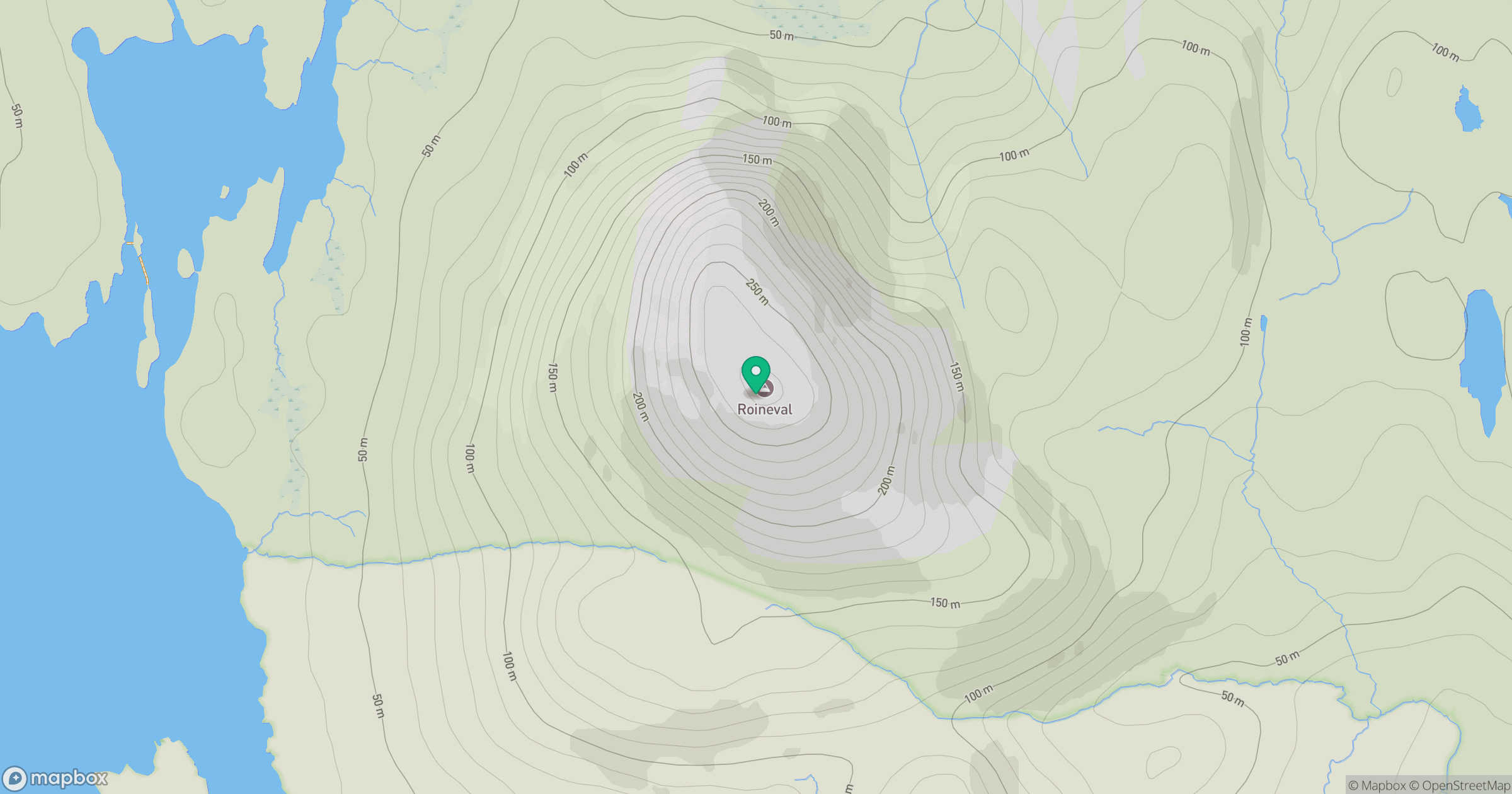
Grid reference: NB232212
View on OpenStreetMapOpens a map in a new tab, centred on the hill.
Hills within 30 km
Straight-line distance, not a walking route or confirmation of access.
An Cliseam [Clisham]
800m
Guaineamol
405m
Cearnabhal [Kearnaval]
378m
Beinn a' Mhuil
370m
Beinn Mothal [Ben Mohal]
207m
No comments yet. Be the first.